(For a full index of the walks, please click here)
 |
The start of the walk in Bothel |
I picked up Andrew at 0730 and drove through the Lake District to Bothel in brilliant sunshine where we parked and then set off for Caermote Hill.
 |
Ancient earthwork 'of obscure purpose' (AW) |
We found AW's route easy to follow and from the summit enjoyed striking views. The slight wind which at first had been sharp was now feeling more comfortable in the strong sunshine.
 |
Summit plaques |
We dropped down to the site of the Roman Camp where five years ago I had noticed only some uneven ground. Today, almost by accident, we found raised turf of what could have been an outer rampart and another inside, or maybe evidence of two camps at different periods.
 |
Part of the Roman camp remains |
 |
Caermote Hill |
As we walked up the road from which the best view of Caermote Hill is obtained we were conscious of the warmth of the sun on our backs.
Unlike on my previous visit, after some hesitation we located the footpath back
up to the ridge, but noted that Wainwright and later Chris Jesty have
omitted a field boundary from the sketch map.
After a short meal in the camper I drove to Caldbeck.
 |
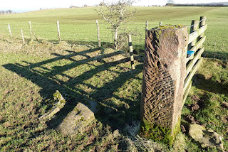
Old gatepost: note the mason's bolster marks |
After a short meal in the camper I drove to Caldbeck.
We trudged up the road to the high ground around Faulds Brow and then made our way over the rough moor to the summit,
passing several of what AW calls craters and a disused quarry on the way.
It was now approaching four o'clock but the sunlight still illuminated a wide clear landscape.
From there we made for the road which leads down to Whelpo, and, taking the delightful footpath by the river, walked back to the car. After the sun went below the hills it was noticeable how quickly our hands felt the low temperature.
I don't recall seeing a bridge over the stream last time I went this way: it is situated perfectly to provide a view over waterfalls tumbling in a narrow gorge. Unfortunately it was too dark for a good photo.
One of our better walks, covering, according to AW, nine miles altogether.
INDEX
 |
Old quarry on Faulds Brow |
 |
Summit cairn; Carrock Fell & High Pike beyond |
It was now approaching four o'clock but the sunlight still illuminated a wide clear landscape.
From there we made for the road which leads down to Whelpo, and, taking the delightful footpath by the river, walked back to the car. After the sun went below the hills it was noticeable how quickly our hands felt the low temperature.
 |
Whelpo Beck |
 |
Whelpo Beck upper waterfall |
I don't recall seeing a bridge over the stream last time I went this way: it is situated perfectly to provide a view over waterfalls tumbling in a narrow gorge. Unfortunately it was too dark for a good photo.
 |
Caldbeck village pond |
One of our better walks, covering, according to AW, nine miles altogether.
INDEX