Sat 19 May 2018
For an index to my other walks please click here
 |
Double Hole Bridge, Grisedale |
Glorious weather, so off we went just after eight, Andrew driving to lonely Grisedale, reached by a side turning off the Garsdale Road just before Garsdale Head. Another hot day was relieved by a gentle breeze.
 |
One of the renovated farm houses |
The valley was regarded as 'dead' in Wainwright's time because all the farms were in ruins, but we found that some of them have been renovated. One individual seems to have been responsible for four of them and is now renting them out so it's tourism that is taking over from food production. Still, although it's romantic to see a whole valley abandoned and in ruins it's so much better to see it inhabited. The public road is a cul-de-sac so there is no through traffic and the valley is quiet and really beautiful.
 |
Quiet and beautiful |
I was wearing my boots and found even the tarmac pleasant: I was raring to go (but for how long?) At Moor Rigg AW suggests leaving the road on the left and taking a pathless route across fields to Grisedale Beck, and following this past Reachey, another renovated small building. It looked as though it went on through potentially swampy marsh (after last winter's heavy rains), to the ruins of Round Ing, the last of the old farms. We like walking, we really do, and following in dear old AW's footsteps, but if possible without sinking up to our knees in slutch.
 |
On 'The Pennine Journey' track |
The map shows a perfectly viable route on higher dry ground, which we reached by continuing along the road as far as East House. There the surface changes to a typical stony track, dusty but pleasantly dry. We arrived at a T junction of lanes and turned left, passing a lime kiln with the front arch propped up to prevent it falling.
 |
Renovated lime kiln! |
Why didn't AW even mention this track? After all, he must have known it was there, because he had tramped along it in the nineteen thirties on his Pennine Journey. Of course the O.S. map he used when writing the Howgills Book would not have shown it marked as such. AW either forgot about it, or he didn't see the point of referring to it as his book on the Pennine Journey hadn't been published.
 |
A lovely dry track leads into the wide valley |
 |
Round Ing ruin is just visible by the trees |
We were well above the pathless route shown on AW's map, and the ruin of Round Ing was almost lost to view below.
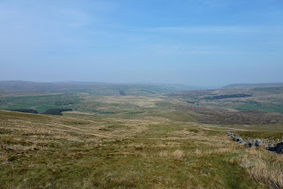
The vista over the wide Grisedale valley is extensive, with Swarth Fell to the right and Baugh Fell up on the left.
We encountered some mud later near an old barn where cattle, young heifers, had been trampling about, not caring about getting their feet dirty, nor leaving the track in a mess for walkers. There was only one young thing there today, and being unsociable (thank goodness) she did more trampling in the mud in front of us all the way to the open fell.
 |
A second lime kiln |
In the sun it was hot going past small limestone formations and a second kiln. We searched around in the grassland but we couldn't locate AW's cave. It took some deliberations to identify the correct route up Baugh Fell, although it had at first seemed obvious to me. Andrew didn't appear to agree: he enjoys the challenge. It was tempting to just sit and enjoy the wide vista of totally unspoilt fellsides.
 |
Beautiful primroses |
 |
Small rocky formations - but no cave |
 |
Go left? Right? |
The slog up the pathless moor was wearisome, but bearable, and looking back we thought we could see the cave in a small bank of limestone, although it had looked just like a peat hag when glimpsed earlier.
 |
East Tarns |
After a long tramp we reached East Tarns and even then it seemed a long way across the relatively flat ridge to the wall on Tarn Rigg Hill.
 |
What? Come all this way for...this? |
This was the summit! Just a wall corner. Great! Tired, I lay down, thankful for a rest, while Andrew trundled off to the summit of Knoutberry Hill, or Baugh Fell (West) in AW parlance, doing the return journey inside half an hour. I didn't really miss out, though, because I had visited that top on 6 April 2002.
 |
West Baugh Fell - another story |
We couldn't at first locate the multiple cairns on Grisedale Pike, although we'd spied them on the ascent earlier. By the time we had walked along the wall and they had come into view both of us were too leg-weary to go and visit them. Shame!
 |
Cairns on Grisedale Pike |
 |
A trudge - but downhill |
It was a long trek down by the wall
towards the road, but what a vista! When we expected the continuation of the path over
a slight rise it was a pleasant surprise to realise that we were, in fact, but a
few yards from the car!
This time Andrew admitted he would
not like to go round again today; perhaps I should have suggested he ought to try? We
were both hot, tired, and hungry, faced with at least an hour and a half driving home.
My knees didn't ache as they had last
week, because the gradients weren't nearly as steep, and I had my comfortable
Anatom boots on, so I can call today's walk a truly enjoyable one. Gad!
it's good to get out in the wild!Index